Cycling Projects
Improving Cycling Infrastructure and Services
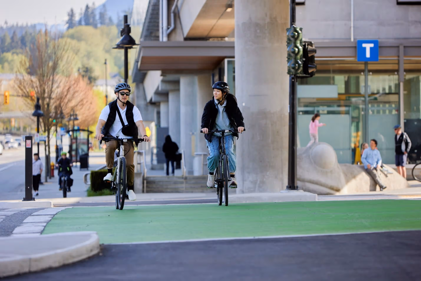
Infrastructure improvements to support active transportation choices throughout the region are currently underway.
We work with our municipal stakeholders to maintain and improve regional cycling routes like the Major Bike Network, BC Parkway and Central Valley Greenway, as well as local bikeways, to keep them safe and reliable for communities across Metro Vancouver.
We also make it easier for customers to combine cycling with their transit trip by providing a variety of bike parking options throughout the transit network, including Canada's largest transit-integrated network of Bike Parkades.
These ongoing improvements support Metro Vancouver's vision to make cycling in the region accessible for everyone, as set out in our Regional Cycling Strategy.
BC Parkway
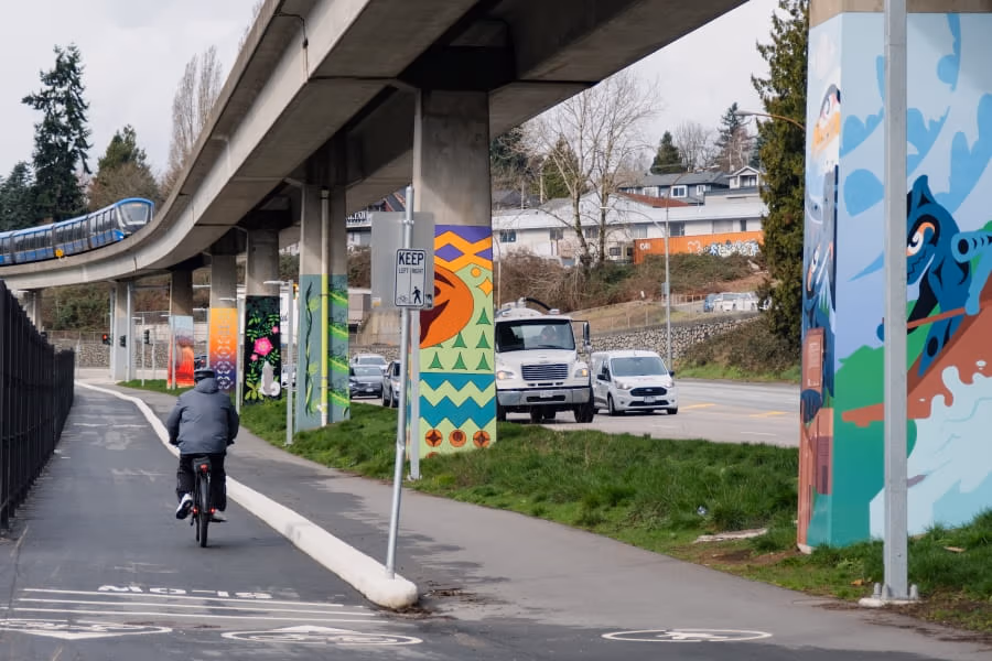
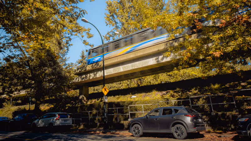
BC Parkway is a 26-kilometre, multi-use path that follows SkyTrain’s Expo Line, connecting Surrey City Centre, New Westminster, South Burnaby and Vancouver. The route offers a one-path ride through four municipalities for commuters and endless opportunities to explore vibrant neighbourhoods and parks.
BC Parkway forms part of the Major Bikeway Network which is the proposed 850km network of safe and comfortable cycling facilities and infrastructure across Metro Vancouver. Continued investment in regional cycling infrastructure is essential to ensure equitable access to transportation and transit where everyone can feel welcome, comfortable, and safe while getting around.
BC Parkway Annual Rehabilitation Program
As part of TransLink’s ongoing investment in cycling infrastructure throughout the region, we’re making safety and accessibility improvements to BC Parkway. Every year, we complete maintenance activities along BC Parkway to ensure the paths are safe and comfortable for pedestrians and cyclists. This can range from repaving the path to repainting decals to ensure the Parkway is maintained to a state of good repair.
What you need to know
From July to August 2026, TransLink is repainting the faded decals of pedestrians and bikes, and other safety information along BC Parkway. We’re also repainting some fences, benches, and other amenities along the area.
Although the Parkway may have areas that are temporary blocked off, the paths will remain accessible. Signs and delineators will be in place while painting is ongoing.
BC Parkway Upgrade Projects
BC Parkway was originally constructed more than 30 years ago, when bike paths were an up-and-coming concept and there were few established requirements for path design.
Since 2014, TransLink has been making ongoing improvements to the aging Parkway, including path rehabilitation and widening where possible, retaining wall upgrades, and accessibility upgrades to make BC Parkway safer and more enjoyable for all users – daily commuters and fun-seekers alike!
Investing to maintain the safety and reliability of BC Parkway is a key part of our goal to make cycling an easier choice for transportation and exploring for more people throughout the region.
2021 BC Parkway Upgrades
In 2021, we made improvements to BC Parkway at several locations throughout Burnaby, New Westminster, and Vancouver.
Upgrades included:
-
The replacement of aging path, curbs, and retaining walls to maintain the safety of BC Parkway for all users.
-
The addition of wheelchair ramps at two locations in Vancouver to improve accessibility.
Locations:
-
Burnaby
-
Along Central Boulevard from Patterson Station to Willingdon Avenue
-
New Westminster
-
South of Grimston Park, along lane east of 20th Street
-
Vancouver
-
South end of Gladstone Street
-
East of Nanaimo Station in the lane north of E 26 Avenue
-
The lane between Rupert Street and Manor Street
Related Documents
Joyce–Collingwood to Buller Ave Upgrade Project
Project Overview
TransLink is designing upgrades to parts of the BC Parkway to improve safety and accessibility for everyone, whether you're walking, rolling, or cycling. Two segments were chosen due to the high volume of people they serve.
Imperial Street to Buller Avenue

Current stage: Detailed designs are anticipated to be completed by fall 2025
Proposed designs:
-
Separated pathways for pedestrians and cyclists.
-
An improved signalized crossing at Royal Oak Station.
-
Intersection improvements at Nelson Avenue, MacPherson Avenue, and Buller Avenue.
-
Improved access points and crossings between the BC Parkway and nearby neighborhoods.
-
Upgraded signage and pavement markings.
-
Enhanced landscaping and plantings.
-
Improved lighting.
Joyce-Collingwood to Patterson Station
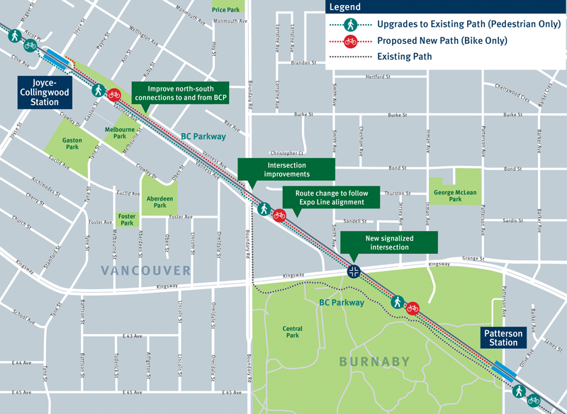
Current stage: Preliminary designs are anticipated to be completed by spring 2025
Proposed designs:
-
Separated pathways for pedestrians and cyclists.
-
A new signalized crossing at Kingsway near Smith Avenue.
-
Intersection improvements at Boundary Road and Vanness Avenue.
-
Improved access points and crossings between the BC Parkway and nearby neighborhoods.
-
Upgraded signage and pavement markings.
-
Enhanced landscaping and plantings.
-
Lighting improvements.
-
A potential realignment of the Parkway through Central Park to more directly follow the Expo Line, with a new signalized crossing at Kingsway near Smith Avenue.
Frequently Asked Questions
Why are you doing this work now?
This segment of the BC Parkway was originally constructed in 1985, and the existing infrastructure is reaching the end of its useful life. These designs are intended to make the Parkway more accessible, ensuring it meets the needs of all users and improves connections between the Parkway and surrounding neighborhoods.
Additionally, the project addresses community concerns by creating a safer, more welcoming environment. Our goal is to make active transportation a more appealing and convenient choice for everyone.
Why are separated pathways beneficial?
Compared to multi-use facilities, separated bicycle and pedestrian pathways create a safer and more comfortable environment for all pathway users. Separating different modes helps to minimize potential safety conflicts between people walking and faster-moving active transportation users.
Will there be any public consultations regarding these improvements?
TransLink will assess the public engagement requirements for each project based on the specific concerns and interests of the local community. This provides opportunities for community input and ensures that the improvements consider local needs and preferences.
For the upcoming improvements in Burnaby, TransLink will collaborate with the City of Burnaby for joint public consultations scheduled for October 2024.
What are the next steps for this project?
We will continue working with our municipal partners to finalize designs. Construction will take place subject to funding approvals as part of the 2025 Investment Plan.