Bus Projects
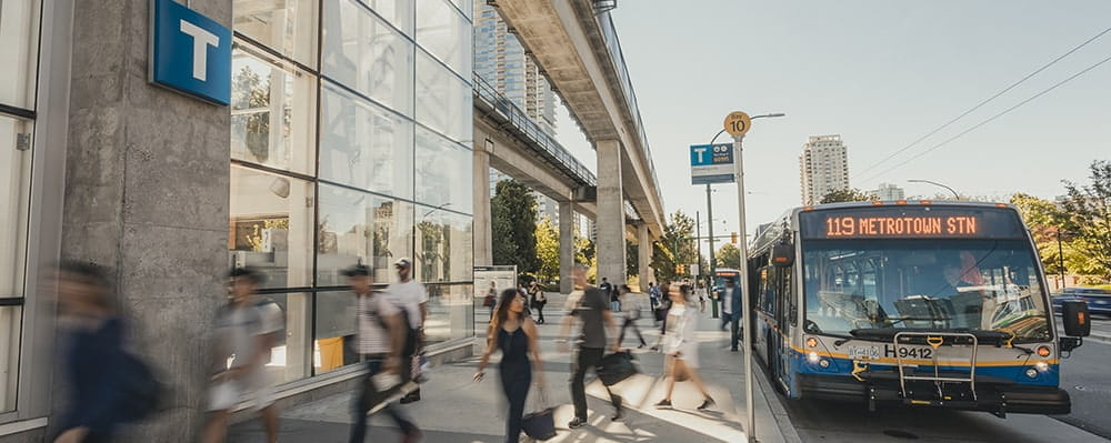
The quality of our bus service and facilities are paramount to the success of our system. We have several infrastructure and fleet projects underway to improve bus speed and reliability, and our customers’ experience on our bus network.
Many of these projects support the vision and requirements of our three main transit expansion plans: Transport 2050, the 10-Year Investment Plan, and Area Transit Plans.
| Completed | Under construction | Design phase |
Transit Centre and Bus Exchange Projects
Marpole Transit Centre
The Marpole Transit Centre is being built to accommodate the growing demand for public transportation in Metro Vancouver. When completed, this facility, located around Laurel and Cambie Steet in Vancouver, will be the future home to approximately 300 forty-foot buses, most of which will be 100% electric, zero-emissions vehicles.
Project Overview
The new transit centre will be located at 502 West Kent Avenue South in Vancouver and will include:
-
Three-level bus garage building for bus staging and storage at ground level, bus charging infrastructure and an electrical substation on the second level, and administrative facilities as well as employee and visitor parking on the third level;
-
Two-level maintenance building including bus maintenance and repair bays, body shops, parts storage, and support areas for mechanics and maintenance staff;
-
Bus fueling facility and a bus wash and detailing facility.
Besides being part of TransLink’s low carbon fleet strategy, the new centre will provide a more reliable bus service for customers across Metro Vancouver. The center was included in the Mayors’ Council’s Ten-Year Vision and funded through the Phase Two Investment Plan. The Marpole Transit Centre is key to reaching TransLink’s goal of 100% net-zero GHG emissions by 2050.
For more information, please see the Marpole Transit Centre - DP Board Presentation.
Construction Information
Foundation piling work will commence at the end of July 2024 and is scheduled to be completed in approximately nine months. During this time, neighbours can expect to see hydraulic crawler cranes across the site and may experience loud noises during daytime hours. Together with the contractor, TransLink is making every effort to minimize the impact of this project on our neighbours.
The estimated opening of the Marpole Transit Centre is in 2028. For further questions about this project email publicengagement@translink.ca.
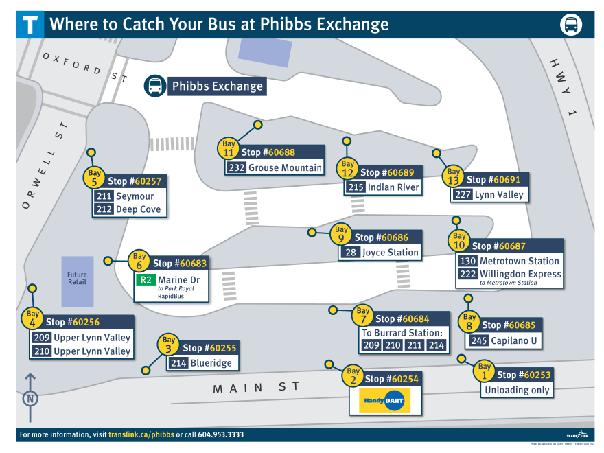
Phibbs Exchange
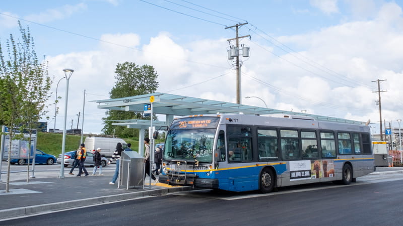
Phibbs Exchange has been reopened in May 2024 after more than a year of extensive upgrades. The exchange has been expanded to offer a modernized and accessible transit experience with more comfort, security, and amenities for customers, space for high-capacity articulated buses, and is ready for future service expansions.
Phibbs Exchange is one of the most important bus exchanges in the region, with 13 bus routes serving over 5,000 customers daily. Because of its position in the regional road network, the exchange is where many routes on the North Shore meet in a carefully managed pulse, allowing efficient transfers in all directions.
Upgrade Highlights:
-
13 new and modern bus shelters with more seating space and rain protection
-
Better lighting for improved safety and comfort
-
Seven new, on-demand bike lockers that can hold 14 bikes, and new bike racks
-
A multi-use pathway to provide better access to the exchange for pedestrians and bikes;
-
New commercial retail space that will be open later in 2024
-
New and vibrant landscaping with a rain garden for improved drainage
-
A boomerang-shaped passenger platform along the perimeter to serve major bus routes that can support articulated buses such as the R2 RapidBus
-
Distinctive public art to honor the Indigenous history of the land, to be installed later this year
These upgrades were made possible by all levels of government working together and with provincial and federal contributions through the Investing in Infrastructure Canada Program (ICIP).
Phibbs Exchange was closed from July 2023 to facilitate construction activities; during this time, bus bays were relocated to nearby streets. The bus bays are now located within the exchange, the new configuration is in the table and map below:
| Bay | Stop # | Route |
|---|---|---|
| 1 | 60253 | Unloading only |
| 2 | 60254 | HandyDART |
| 3 | 60255 | 214 Blueridge |
| 4 | 60256 | 209/210 Upper Lynn Valley |
| 5 | 60257 | 211 Seymour 212 Deep Cove |
| 6 | 60683 | R2 Marine Drive to Park Royal |
| 7 | 60684 | 209 Burrard Station 210 Burrard Station 211 Burrard Station 214 Burrard Station |
| 8 | 60685 | 245 Capilano University |
| 9 | 60686 | 28 Joyce Station |
| 10 | 60687 | 130 Metrotown Station 222 Willingdon Express to Metrotown Station |
| 11 | 60688 | 232 Grouse Mountain |
| 12 | 60689 | 215 Indian River |
| 13 | 60691 | 227 Lynn Valley |
Annual Pavement Rehabilitation Program
We’re keeping bus loops and depots safe and accessible for customers and transit staff though our Annual Pavement Rehabilitation Program. Construction takes place during the summer months and is focused on resurfacing asphalt walking, driving, and parking areas at a handful of priority locations each year. Thank you for your patience as we improve your transit experience for years to come.
For updates about impacts to your bus route, subscribe to Transit Alerts.
Active Projects
Knight Street Bus Loop
Anticipated completion: July 2025
-
From June 27-30 and July 3-6, 2025, route 22 Knight/Downtown will operate via a shuttle between E49th St to Knight Street Loop. Please allow an extra 15 minutes travel time if this impacts your trip.
Past Projects
We recently completed pavement rehabilitation projects at the following bus loops:
2024
Maple Meadows Park and Ride Bus Loop
2023
Scott Road Bus Loop
Boundary Loop
Kootenay Loop
Thank you for your patience during construction!
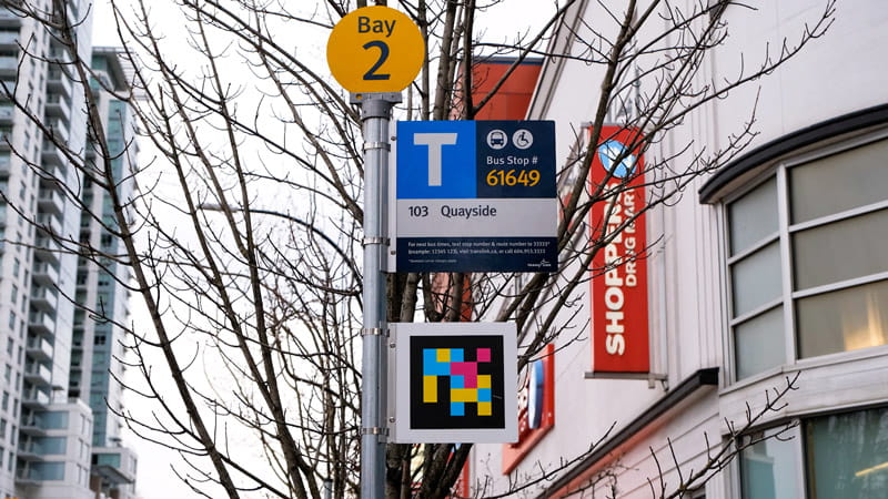
Braille and Tactile Walking Surface Indicators
TransLink has installed braille signage on every bus stop pole across the system. To make it easier to find bus stops, TransLink has also installed tactile walking surface indicators (TWSI) at every bus stop on TransLink-owned property.
The braille bus stop signs contain:
-
Information written in both Unified English Braille and raised tactile letters
-
Bus stop ID numbers
-
Bus routes serving that bus stop
-
Bay or bus stop indicators
-
Customer Information phone number
In addition to the braille signage, tactile walking surface indicators are installed at every bus stop on property that TransLink owns. These raised surface indicators are mounted on the ground to help customers who are blind or partially sighted know they are near a bus stop while helping direct them to the front door of the bus.
These improvements help customers who are blind or partially sighted to better navigate the transit system by letting them know which stop they are at and which buses they are waiting for. TransLink was the first transit system in Canada to install braille signage across its entire bus system.
Accessible Navigation Project
TransLink finished piloting a new technology that focused on making it easier for customers with sight loss to navigate the transit system. Using the NaviLens smartphone app, customers were able to receive audio and haptic cues to help find their bus stop and receive other updates in three locations in New Westminster and Vancouver. The six-month pilot launched on Tuesday, February 21, 2023, and concluded on Monday, August 21, 2023.
Background
As part of our commitment to making transit more accessible, we partnered with NaviLens to bring their accessibility technology to Canada for the very first time. We asked customers with sight loss to try the pilot system and give us feedback based on their experience.
The system was enabled by the installation of 16 coded decals in the pilot area, which could be read using the NaviLens app to up to 14 metres away, depending on the angle of detection. Once the app read these proprietary QR codes, customers received navigational audio and haptic cues to identify their bus stop and the exact point of pick up.
Customers were also able to receive real-time bus arrival times and service alerts. The app also offered the functionality to identify relevant facilities in the location, such as elevators. Customers were able to set their notification preferences in the app by selecting one of 34 languages to receive their audio cues in.
Implementation
The technology was implemented at 16 designated bus stops in New Westminster and Vancouver. Customers with sight loss were asked to download and use the NaviLens app (either on Android or iOS) at the stops.
For the purposes of the Accessible Navigation Project, people with sight loss within TransLink’s service area were the primary target for outreach. A group of participants tested the technology and provided feedback during moderated demonstration sessions. A public online survey was available for others to provide feedback on their experience using the technology.
Outcomes
The Wayfinding Technology pilot provided valuable insights into wayfinding technology. These lessons will be incorporated into broader wayfinding improvements as the opportunity arises, to ensure improvements are inclusive and accessible.
Trolley Bus Rectifiers
Rectifiers are found throughout Metro Vancouver’s bus network and are used to convert AC to DC power to operate the electric trolley bus system.
Parkway Rectifier
The Parkway Rectifier is one of three rectifiers located on the UBC peninsula in Vancouver. Used to help power the trolley bus system in the area, the rectifier is past its functional life and needs replacement since parts to fix the existing rectifier are either not available or hard to find. With a previous failure of another rectifier in the region (Cleveland Rectifier) there is no longer a redundant rectifier should the Parkway or Blanca Rectifier stop working. This would put the service of the trolley bus system at risk.
Due to the need for electricity to power the trolley bus system, a new location to put the replacement rectifier is needed while we work to replace the Parkway Rectifier.
A proposed location for the replacement rectifier on the northwest corner of Western Parkway and University Blvd met technical requirements but was rejected due to potential impact on an adjacent development and green space, and feedback from the University Endowment Lands (UEL) community.
TransLink listened to the concerns of the community, and identified a new location south of Western Parkway at University Blvd that meets technical requirements. We are working with the adjacent property owner, Regent College, to integrate the rectifier into the streetscape through landscaping.
TransLink will seek feedback from UEL stakeholders on the proposed location for the Parkway Rectifier is from Jan. 8 to Feb. 8, 2024.
Frequently Asked Questions
What consultation has been done on this?
TransLink will consult the community on the proposed location for the rectifier from January-February 2024. This will include outreach to local stakeholders; a development sign application erected at the proposed location; and a presentation at the UEL Community Advisory Council meeting on Jan. 15, 2024.
Feedback from the community during the consultation period will be included in TransLink’s development application submission.
When will construction take place?
Our current timeline is to start construction in 2024 with a completion sometime in 2025.
Can the rectifier be put near the UBC Bus Loop?
Space needed for infrastructure for future battery-electric buses at the UBC Bus Loop, the urgency to replace the existing rectifier, and the need for the rectifier to be close to the trolley wires are reasons why relocating the rectifier to the UBC Bus Loop is not a feasible option.
Can the rectifier be put in the spot where the existing/old rectifier currently sits?
It was determined that the proposed new location on the southwest corner of Western Pkwy near University Blvd is the best alternative to the previous proposed location for the replacement rectifier due to the following reasons:
- The need for the trolley busy system to receive continual power conversion during construction of a replacement,
- The current location is not big enough for the replacement unit,
- To be close to the trolley wires it powers,
- To manage the concern over the originally proposed location on the corner of Westbrook Mall and University Blvd,
- To replace the rectifier before a serious outage in service could happen, and
- To be installed within the limited locations suitable for the rectifier.
Will the installation work be noisy or disrupt traffic?
TransLink always looks for ways to minimize noise and delays to traffic and will provide more information to customers and neighbours closer to the start of construction.
Will the rectifier make noise after it has been installed?
No noise can be heard from outside of the rectifier. To date, we have had no record of any noise complaints for the existing rectifier.
For further questions about the rectifier, email: publicengagement@translink.ca
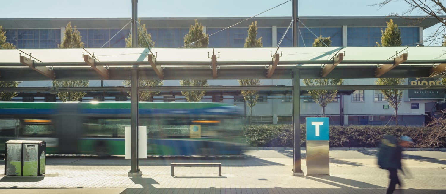
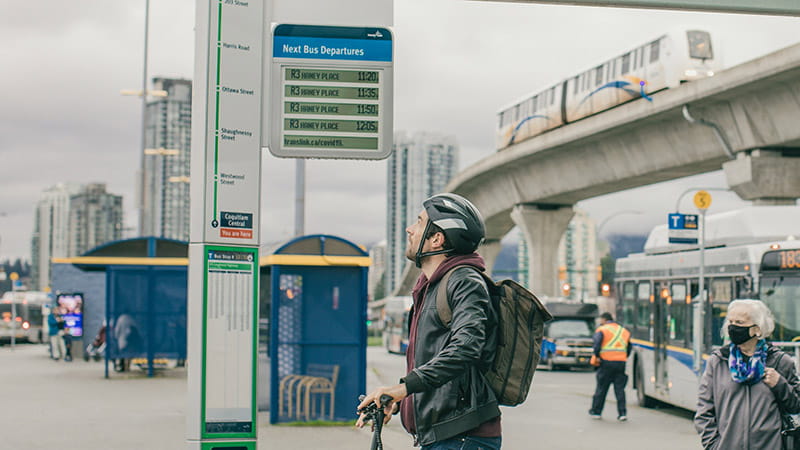
Real-time Transit Information
TransLink is improving bus departure predictions, so riders have accurate and up-to-date information to plan their trips. While we are improving how predictions are calculated, we are also adjusting for changing conditions that affect departure times. These improvements will make departure times more consistent and easier to plan around.
Why Some Next Bus Displays Are Being Removed
Mobile service providers are phasing out the 3G network that powers older Next Bus displays on RapidBus routes R1 to R5, as well as at the South Surrey and Carvolth Exchanges. As a result, TransLink will remove these screens starting Feb. 18, 2025. With these changes, the audio button feature at these stops will be unavailable too. This is a temporary change, and we plan to replace them with upgraded versions as funding becomes available too. While some of these upgrades may take time, we are committed to making bus departure predictions more reliable for all riders.
You can check bus times at translink.ca/nextbus or by texting your stop number and bus route number to 33333. Standard message rates may apply.
New and Improved Next Bus Displays
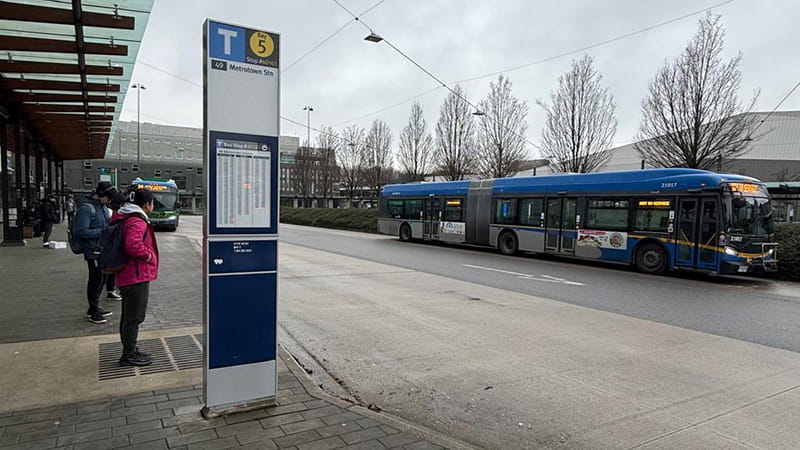
TransLink has introduced upgraded Next Bus displays at UBC Exchange, Phibbs Exchange, and along the R6 RapidBus route. These updated versions connect to 4G networks and are built to support future improvements in bus departure information. These displays also feature a text-to-audio function, allowing users to hear bus departure details at the push of a button. The activation button is marked with braille and raised lettering for accessibility. More of these displays may be added to other routes as funding becomes available.
What’s Next?
These changes are part of a larger effort to provide more accurate and reliable real-time information. While some displays are being removed now, we are working toward a better system that will serve riders more effectively in the future.
We recognize that unexpected delays and road conditions can sometimes impact departure times. However, we are committed to making updates as reliable as possible by:
-
Improving how we predict bus departures to make updates more accurate.
-
Upgrading how we track bus locations so departure times are more up to date.
-
Installing upgraded Next Bus displays at more bus stops as funding allows.
We know reliable bus departure predictions matter, and we are committed to improving them so everyone can plan their trips more easily, whether they’re at a stop, on the way, or deciding when to leave.
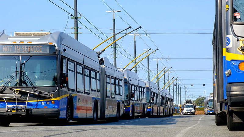
Trolley Bus Fleet Renewal
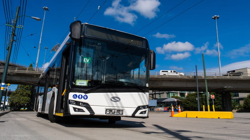
TransLink’s fleet of trolleybuses are nearing 20 years of service life in 2026 and are due for replacement.
On 3 March 2025, TransLink issued the Notice of Award for the contract for new trolleybuses to Solaris Bus & Coach, an industry leader in manufacturing of zero-emission buses. Solaris was selected for their high-quality trolleybus design, proven track record for service, and ability to deliver cost-effectively while meeting our fleet replacement timelines. The contract value is $181 million for the purchase of 107 40-ft trolleybuses, with the option to purchase additional buses to replace the entire fleet of 262 trolleybuses. The options, if fully exercised, is for up to 201 additional 40-foot buses and up to 204 articulated, 60-foot trolleybuses.
Our newest fleet of trolleybuses will use the overhead trolley wires for propulsion and have traction batteries that charge while the bus is in motion. Traction battery power allows the bus to operate away from the overhead system if needed and can provide off-wire service for approximately 20 km. Our current trolleys can only travel a couple hundred metres using their on-board battery and are designed to travel around blockages, not for regular operations.
We expect to receive the new fleet in 2026 starting with a pilot 40-foot Solaris Trollino 12 bus; the remaining trolleybuses will get delivered and start entering service in 2027 after testing and evaluation of the pilot bus.