Safety and Security
Safety is our top priority. We’re committed to delivering a transportation system that puts the health, safety, and security of customers and employees first.
Sign Up for Transit Alerts
Stay informed about any delays or issues on your travels. Sign up to receive enhanced personalized alerts for your favourite routes, stations, and more.
Safety Tips
While on the transit system, here are a few tips to keep yourself safe:
-
Watch your step when entering or exiting a transit vehicle.
-
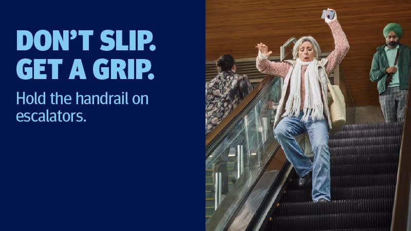
Hold on to handrails while on escalators or stairs.
-
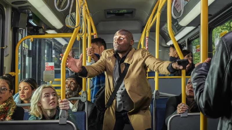
Hold on or stay seated while the transit vehicle is in motion.
-
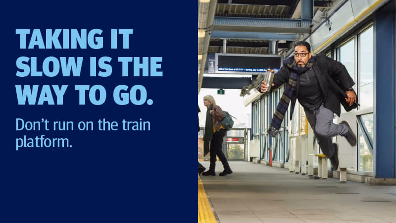
Walk, don’t run in and around stations and exchanges.
-
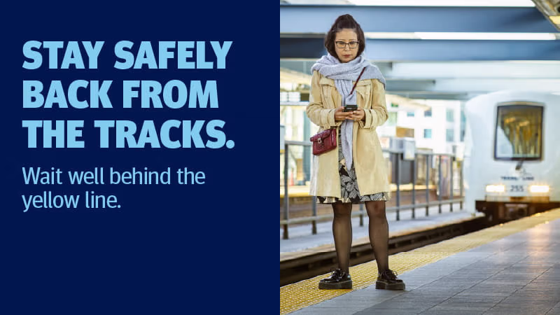
SkyTrain tracks are electrified. Stay behind the yellow line while waiting for your train to arrive.
-
If you see something, say something. Report any unusual behaviour or non-emergency incidents to Metro Vancouver Transit Police by calling 604.515.8300 or texting 87.77.77. In an emergency, call 911.
Escalator and Elevator Safety
For your safety, use an elevator when:
-
You are travelling with large or heavy items such as strollers, luggage, packages, scooters, wheelchairs, or other mobility aids
-
You are experiencing mobility challenges that limit your use of stairs
-
The escalator is out of service and you are unable to use the stairs
Tips for using elevators:
-
Wait for passengers to exit the elevator first
-
Step carefully when entering or exiting the elevator
-
Adhere to posted weight limits and do not get on if the elevator is full
-
Report malfunctions immediately by informing a uniformed staff member
Tips for using escalators:
-
Stand on the right to let others pass on the left
-
Hold on to the handrail for support
-
Face forward and keep feet clear of edges
SkyTrain Platform Safety
SkyTrain track guideways are electrified and can pose serious risks. For your safety, please adhere to the following guidelines:
-
Stay behind the yellow line
-
Do not lean over or dangle feet from the platform edge
-
If you drop something on the track;
-
Do not attempt to retrieve the item
-
Contact transit staff immediately for assistance
-
Pedestrian Safety
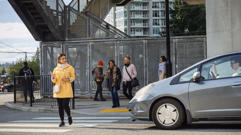
Your journey doesn't start or end on transit — it begins the moment you leave your door. Whether you're walking to the bus stop or heading home from a SkyTrain station, following a few simple tips can help keep you safe:
-
Wear bright or reflective clothing, especially in low-light conditions, so drivers can see you clearly.
-
Make eye contact with the driver before stepping into the street.
-
Always use designated crosswalks or intersections where drivers expect pedestrians.
-
Remove distractions. Take out your headphones and put your phone away while crossing the road to stay alert to your surroundings.
-
Watch for turning vehicles and stay cautious at intersections. Drivers may be watching for oncoming traffic and not notice you at the crosswalk.
Emergency & Security Features on Transit
When using public transit, please stay aware of your surroundings. If you see something, say something — report any unusual behaviour or incidents to a uniformed transit employee or by texting Metro Vancouver Transit Police at 87.77.77 (Note: standard carrier text messaging rates may apply).
Reporting an Incident
For emergencies call 911.
For non-emergencies contact Transit Police directly:
-
Call 604.515.8300
-
Text 87.77.77
In an emergency call 911. An emergency is when:
-
There is an immediate threat to a person or property.
-
A serious crime is in progress or has just occurred (e.g., a fight, sexual assault or robbery).
-
You see something immediately suspicious (like an abandoned package, or passenger behaving suspiciously).
When calling 911 let the person on the phone know:
-
how you are travelling (e.g., SkyTrain and/or SeaBus)
-
your location (e.g., the nearest bus stop or SkyTrain station)
-
your direction of travel (e.g., toward Waterfront Station)
-
your route or vehicle number (e.g., 17 bus, West Coast Express train number)
You can also ask a uniformed staff member to call 911 for you.
Bus and SeaBus
Emergency support: Every bus and SeaBus has an on-board communication system that keeps drivers in touch with a contact point 24 hours a day, seven days a week to provide support in the event of any safety or security issues. SeaBus Attendants are also trained to provide first aid and emergency response.
Request a stop: To stay safe when travelling at night by bus, you can request a stop from 9 p.m. to 5 a.m. daily. Let your bus driver know where you’d like to get off the bus and they'll find a suitable safe spot to let you out. You cannot request a stop along an express or limited-stop portion of a route.
SkyTrain
SkyTrains are monitored by customer service and security staff during operational hours. We have the following added security measures on SkyTrain:
-
The passenger silent alarm is a yellow strip above every window. When pushed, staff will be silently alerted to a problem. Help will be on the scene as soon as possible.
-
Speakerphones to talk to SkyTrain control operators are located inside each car near the doors, so passengers can ask for urgent assistance.
Our SkyTrain stations also have special security features:
-
Designated waiting areas are located on all platforms. These areas have brighter lighting, red emergency telephones, and a bench. They are monitored by security cameras (CCTV).
-
Emergency cabinets are located on SkyTrain platforms. Each has a red emergency telephone, a fire extinguisher, and emergency train stop buttons.
-
Security cameras (CCTV) monitor all areas of our stations. This enables staff to quickly respond to emergencies and record video of any incidents or crimes.
SkyTrain Attendants are also trained to provide first aid and emergency response.
West Coast Express
All West Coast Express stations have CCTV security cameras. Station Attendants are available when trains are running, and security services patrol seven days a week.
Every West Coast Express train is staffed by a uniformed engineer and a conductor. Please approach these staff for help on board.
Each car also has a Passenger Silent Alarm (the yellow strips above every window) and a speakerphone to ask for help if you can’t immediately find a staff member.
Transit Police
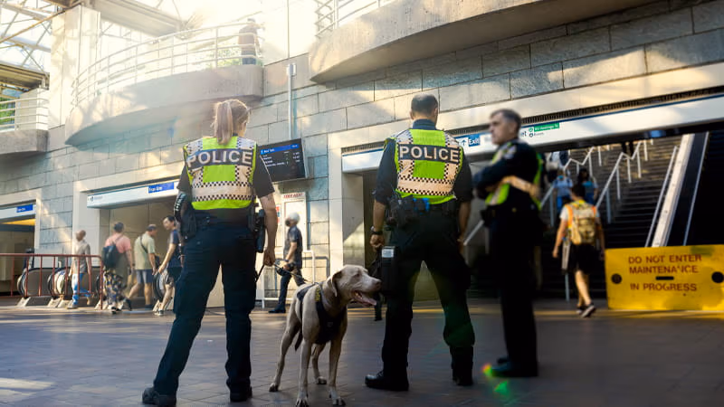
Metro Vancouver Transit Police is the only dedicated transit police service in Canada. They are responsible for ensuring the safety of customers and employees across the transit network, including the twenty-one municipalities and one First Nation. They work in partnership with jurisdictional police, RCMP detachments, and the rest of the TransLink enterprise.
For updates and more information about Metro Vancouver Transit Police, visit the Transit Police website.
Transit Security
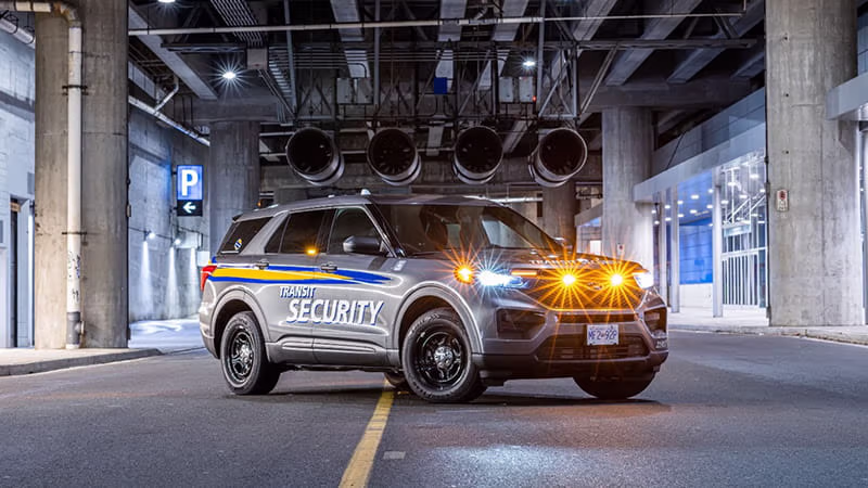
Transit Security provides proactive, high visibility presence using mobile, foot, and bike patrols throughout Metro Vancouver’s transit system. They respond 24/7 to security related calls throughout the transit network to serve and protect customers, employees, and the community.
Officers enforce the Transit Tariff, as well as bylaws, rules and regulations on and around transit. They can also issue Fare Infraction Notices. They also have a responsibility to act as a major support role for other departments within our transit network, such as Transit Police.
Visit the Transit Security page to learn more about their mandate, history and more.
How We Keep the System Clean
Everyone can help prevent the spread of germs – including colds, flus, and COVID-19.
While you are in stations, riding buses or trains, remember these tips:
-
Stay home when unwell, avoid touching your face, and cough/sneeze into your elbow.
-
Masks are welcome on bus, SeaBus, SkyTrain, West Coast Express, and HandyDART services to help customers and employees feel safe, based on their individual comfort level.
-
Sanitize your hands before and after riding transit.
We continue to work closely with health officials to do our part to keep our employees and riders safe.
Across SkyTrain, bus, SeaBus, West Coast Express, and HandyDART vehicles, we conduct daily cleaning as well as full interior deep cleans on a regular basis.
Ventilation on Transit
The ventilation on our buses and on SkyTrain allows fresh air to circulate easily through our fleet. Between the multiple ventilation systems, and the doors opening frequently, we’re keeping our customers safe.
Ventilation on Buses
Ventilation on SkyTrain
Cleaning and Maintenance Text Line
The Cleaning and Maintenance Text Line makes it easy for customers to report areas in select SkyTrain stations that require cleaning or maintenance attention. By allowing customers to send in real-time feedback, this program aims to improve overall cleanliness and make our transit system more welcoming for customers.
Using their mobile devices, customers can send a text message to report any cleanliness issues at the ten participating SkyTrain stations:
-
Vancouver station(s):
Commercial–Broadway, Main Street–Science World, Waterfront, Burrard, Granville, Stadium–Chinatown, Joyce–Collingwood
-
Burnaby station(s):
Brentwood Town Centre, Lougheed Town Centre, Metrotown
-
New Westminster station(s):
New Westminster
-
Surrey station(s):
Gateway, King George, Scott Road, Surrey Central
Report a SkyTrain Station Issue
Have a cleanliness or maintenance issue to report at a participating SkyTrain station? Use the link below to send us a text on your mobile device:
Note: standard carrier text messaging rates may apply.
Lost and Found
If you've left something behind on a recent trip, fill out our Lost and Found form.
Late Night Bus Service
For safe, expedited late-night transit options from Downtown Vancouver, learn more about NightBus service.