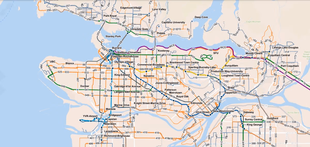
Interactive System Map
Our interactive map offers a robust digital alternative to our traditional PDF maps. This map contains official TransLink data for the following:
-
Bus stops
-
Bus routes
-
SkyTrain lines
-
SkyTrain stations
-
SeaBus terminals
-
West Coast Express line
-
West Coast Express stations
-
Bus depots
-
Bike parkades
-
NEW - BC Ferry connections
-
NEW - BC Transit connections
Information
-
Zoom: Try zooming in and out to see additional layers on the map. More layers will become visible the further you zoom-in, such as bus stops.
-
Layers: Only want to see SkyTrain lines? Then disable the other layers via the "Layers" panel in the left-rail menu.
-
Legend: Unsure of what you're looking at? Please see the "Legend" also located in the left-rail menu.
-
Search: You can search for destinations in the search box in the top-right corner. Enter any location, such as "YVR", to see all transit options near the Vancouver International Airport.
-
Details: Select a bus stop, depot, or SkyTrain station to see a details pop-up which contains information such as connections, launch dates, lat/long and more.
Feedback
What do you think about this map? Please share your thoughts via the survey link below.
Take the survey