Public Engagement on Bus Stop Changes
Feb. 9 to March 1, 2026
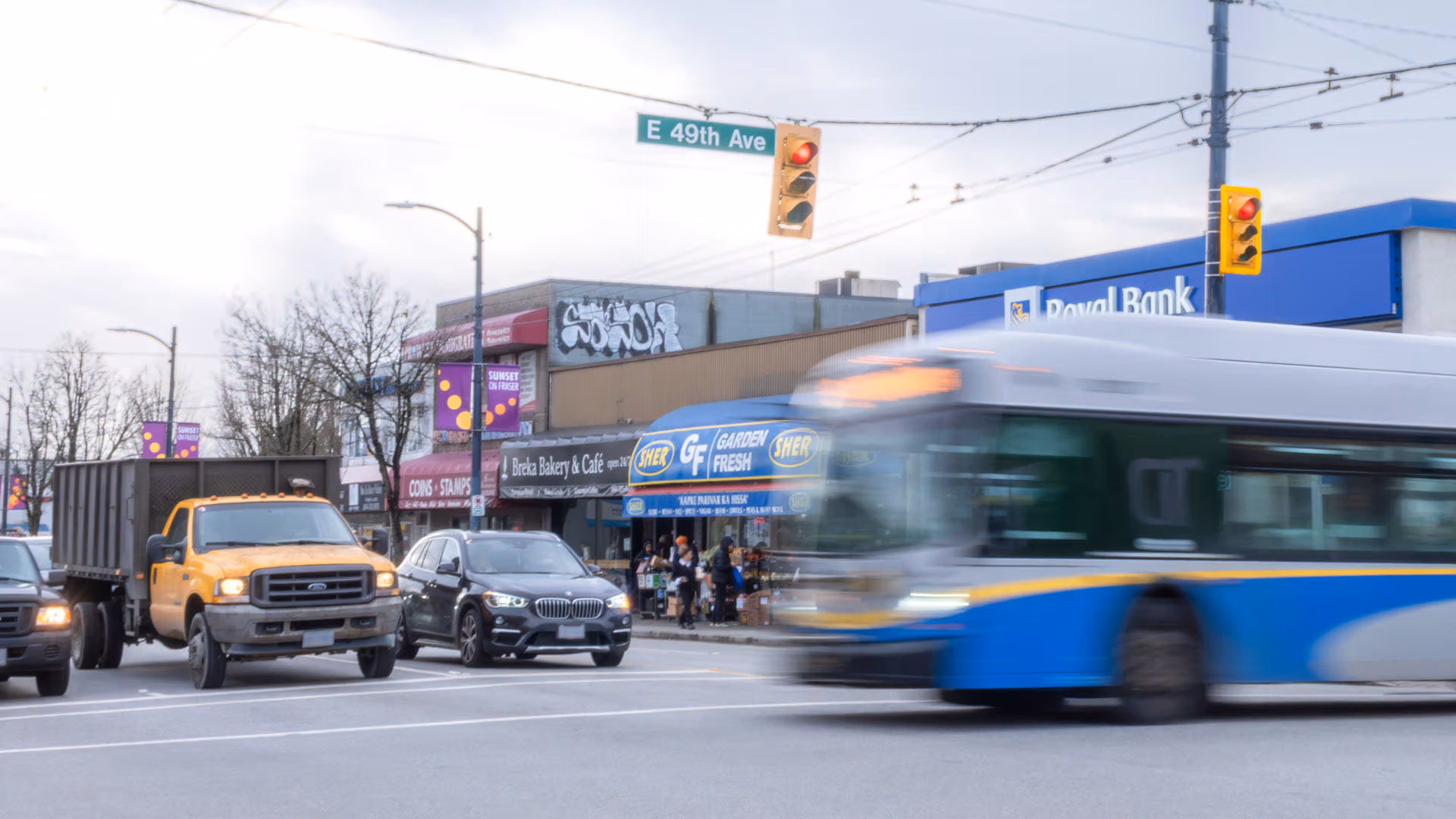
Route 49 is the region’s third busiest bus route, connecting neighbourhoods and schools between Metrotown Station and UBC Exchange. Each year, buses on the route serve more than 8.5 million trips, yet about one in four runs off schedule.
Together with the City of Vancouver, we’re adjusting bus stop locations and extending bus lanes along parts of this busy transit corridor to help more people get where they need to be, reliably and on time.
About half of the bus stops on Route 49 are spaced closer than the recommended minimum distance of 300 metres between stops. When stops are too close together, buses merge in and out of traffic more often, leading to delays.
Starting June 8, 2026, we’re spacing stops more evenly along Route 49 between Crown St. and Boundary Rd. to make trips quicker and more predictable. These changes were made following three weeks of engagement on a proposed plan.
Select a stop on the map below to find out what is changing and why.
For a better viewing experience, we recommend opening the map in a new tab
Thank you to everyone who completed the survey on bus stop changes. Your feedback helped inform our work and shape the final plan. Based on the feedback received, nine stops proposed for removal will now be kept.
People support changes needed to make service faster and more reliable, provided walking distance and safety are thoughtfully considered.
Seniors, families, and people with accessibility needs said shorter walking distances are important, especially in poor weather and on steep roads.
Bus stops are preferred near marked or signalized pedestrian crosswalks.
People wanted bus stops near major destinations, schools, and seniors' facilities.
Some people wanted more visible improvements, such as bus lanes and bus shelters.
Customers wanted to spend less time waiting for the bus.
Read the full Engagement Summary Report to learn more about what we heard and how feedback informed the final plan.
About one in three stops that are less frequently used or spaced too close together may be removed or relocated
One new stop is being added to maintain access and convenience
More than 95 per cent of riders would continue using their current stop
Where a stop is removed, another is typically available within about one block
Some stops shared with routes 41 and 26 may also change
We proposed changes to these stops, but we decided to keep them in service based on the feedback we received during a three-week engagement process.
WB W 41 Ave at Holland St (51895)
EB W 49 Ave at Montgomery St (51962)
WB W 49 Ave at Montgomery St (52038)
EB E 49 Ave at Saint George St (51973)
WB E 49 Ave at Saint George St (52028)
WB E 49 Ave at Fleming St (52021)
WB E 49 Ave at Bruce St (52020)
EB E 49 Ave at Frontenac St (51992)
WB E 49 Ave at Frontenac St (58281)
We’re proceeding with changes to these stops after balancing feedback we received and a technical analysis. Where a stop change is taking place, customers can find the next available stop about a block away.
Between Crown St. and Dunbar St
WB W 41 Ave at Olympic St (51894) (also serves #41)
EB W 41 Ave at Highbury St (51890) (also serves #41)
NB Dunbar St at W 43 Ave (52054)
SB Dunbar St at W 43 Ave (51944)
Between Balsam St. and Granville St.
EB W 49 Ave at Balsam St (51952)
EB W 49 Ave at East Blvd (51955)
EB W 49 Ave at Angus Dr (51957)
EB W 49 Ave at Marguerite St (51958)
WB W 49 Ave at Adera St (52042)
EB W 49 Ave at Churchill St (51959)
Between Granville St. and Cambie St.
WB W 49 Ave at Laurel St (52036)
Between Cambie St. and Knight St.
EB E 49 Ave at Quebec St (51970)
EB E 49 Ave at Prince Albert St (51976)
WB E 49 Ave at Elgin St (52024)
Between Knight St. and Victoria Dr.
EB E 49 Ave at Dumfries St (51980)
EB E 49 Ave at Commercial St (51982)
WB E 49 Ave at Beatrice St (52019)
Between Victoria Dr. and Boundary Rd.
WB E 49 Ave at Gladstone St (52017)
EB E 49 Ave at Gladstone St (51984)
We are adding a new stop to improve the stop spacing between the next and previous stops.
Between Arbutus St. and Granville St.
EB W 49 Ave at Wiltshire St
The City of Vancouver is planning bus lane improvements along parts of 49th Avenue. The first phase will see bus lanes added in both directions between Cambie St. and Fraser St. from 7 a.m. to 7 p.m., Monday to Saturday.
To learn more and share feedback on bus lanes, please visit the City of Vancouver's 49th Ave transit improvements page.
For more information on bus priority measures, including changes to bus stop locations, please contact us.
Project email: buspriority@translink.ca
Customer Service: 604.953.3333, 6:30 a.m. to 10:00 p.m, 7 days a week
To learn more about current bus stops and schedules, visit translink.ca/schedules
For more information on bus lanes or changes to public space, please contact the City of Vancouver.
Project Website: vancouver.ca/49ave-transit
Project Email: 49avebuspriority@vancouver.ca
Use the City of Vancouver’s Van311 App, available 24-7
Call 3-1-1
Around half of the stops on Route 49 are closer than the recommended 300 m spacing, resulting in 123 stops per round trip. When stops are too close together, buses pull over more often, slowing down trips and making travel times harder to predict. By thoughtfully adjusting stop locations, buses can stay on schedule and move more people quickly and reliably.
We carefully consider many factors when evaluating stops for relocation or removal. This includes accessibility, ridership, transfer points, nearby destinations, physical constraints (e.g. hills), distance between stops, and impacts on other routes. We also look at whether the stop has a twin stop in the opposite direction, nearby crosswalks, or stop amenities (e.g., shelters or benches).
Finally, we consider locations where customers may benefit from the addition of a new stop, such as areas with higher populations of seniors or people with reduced mobility, as well as areas with a longer distance between stops.
TransLink is working with the City of Vancouver to implement bus lanes along parts of the 49th Avenue corridor. Bus lanes help buses move through traffic more efficiently, supporting reliable service for thousands of transit users. Learn more about the City’s plans for bus lanes at vancouver.ca/49ave-transit.
Since 2020, TransLink and the City of Vancouver have worked together to deliver larger-scale bus stop relocation projects. Five bus routes with up to 80% of stops under 300 m were adjusted. More recently, we adjusted bus stop locations on Route 19 and Granville Street to improve travel times and reliability for customers.
TransLink carefully evaluates every piece of feedback we receive. Public engagement feedback from surveys, community events, and meetings with stakeholders have influenced the final plan in previous projects.
TransLink will work closely with the City of Vancouver to inform transit riders, nearby residents, and businesses about the engagement process. During engagement, transit users may see notices at bus stops, and residents may receive informational postcards.
After public engagement concludes, this webpage will be updated with the final stop locations and an engagement summary. Signage will also be posted at bus stops in advance of the changes taking effect.
Throughout the process, TransLink will continue to engage with City of Vancouver advisory committees, business improvement associations, and transit advocacy groups to share information and hear feedback.
There are no changes proposed to Route 49 stops in the Burnaby, University of British Columbia, and the University Endowment Land areas.
Funding support for this bus priority project comes through TransLink’s Bus Speed and Reliability Program.
TransLink has scheduled bus priority improvements along additional corridors in Vancouver, targeting areas of high delay and high ridership. As part of its Bus Speed and Reliability program, TransLink intends to implement measures to improve travel times and service reliability for transit users.
Adopted in 2018, the Transit Service Guidelines bring clarity and consistency to the process of adjusting and improving transit services to meet evolving customer needs. In the guidelines, stop spacing is measured by dividing the total distance of a given route by the total number of stops on the route minus one. This measure provides average stop spacing in metres. While the average stop spacing on a line should fall between the ranges provided in the guidelines, the actual distance between any two stops on a route can vary, depending on factors such as topography, road design, land use, and location of sidewalks.
For all-day frequent routes, an average spacing of 300 to 800 metres is recommended. The average distance between Route 49 stops, between Boundary Road and Crown St, is currently 280 metres. With our proposed changes, the average spacing will be 382 metres. See pages 24 to 25 of our Transit Service Guidelines for more information.
When bus stops are better spaced, service becomes more reliable, and buses are less likely to bunch together. Evenly timed buses result in a more even distribution of passengers. Time saved on routes allows resources to be used to increase service, helping manage overcrowding across the network.
The safety and security of our customers and employees is important to us. Bus operators are instructed to adhere to posted speed limits and operate safely at all times. Relocating bus stops involves consolidating and removing bus stops that are too close together to improve travel times and reliability for bus customers. This has no impact on the operating speed of buses.
Generally, Canadian and American bus stops are closer together than on other continents like Europe and Asia. Our target of over 300 m matches the spacing in cities overseas with much higher transit ridership. Many cities in Canada and the United States like Pittsburgh, Portland and Montreal optimize bus stop spacing. Los Angeles is currently reviewing and adjusting bus stop placements for their entire network, with a target of 320 m to 480 m spacing.
Metro Vancouver's transportation network, serving residents and visitors with public transit, major roads, bridges and Trip Planning.
TransLink acknowledges we operate on the unceded territories of the First Nations, guardians of this land for countless generations.
As we connect communities throughout the region, TransLink is committed to honouring these long-time caretakers of the territory.
Subscribe to stay current on TransLink projects, service changes, events, promotions and more! You may unsubscribe at any time.
There are no upcoming events
Thank you for your feedback!